COLORADO HISTORY HAUNTS

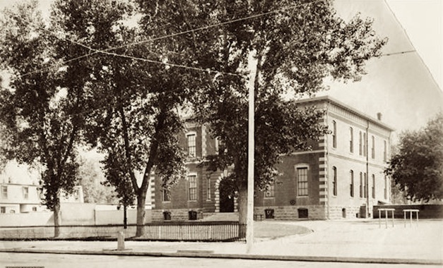
The Broadway School was built in 1875 on land sold to Denver by Henry C. Brown.
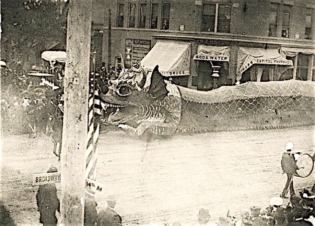
“Silver Serpent” and marching band, part of Mountain and Plain Festival of 1896, at Broadway and 14th in front of the Capitol Pharmacy, in the Huston Block, built in 1889.
WHAT Was REALLY There ? 1880-1908
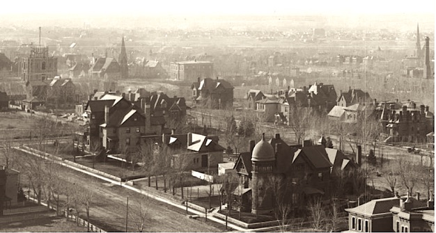
The panograph above is made from DPL photos, all but the first one by William Henry Jackson, taken from the Capitol dome around 1905. Broadway is shown in front of the Capitol building, running from the south to north, left to right.
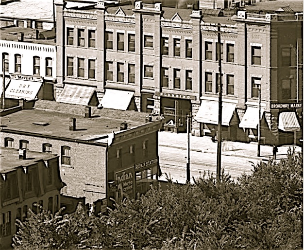
Looking east up 14th from Broadway in 1908.
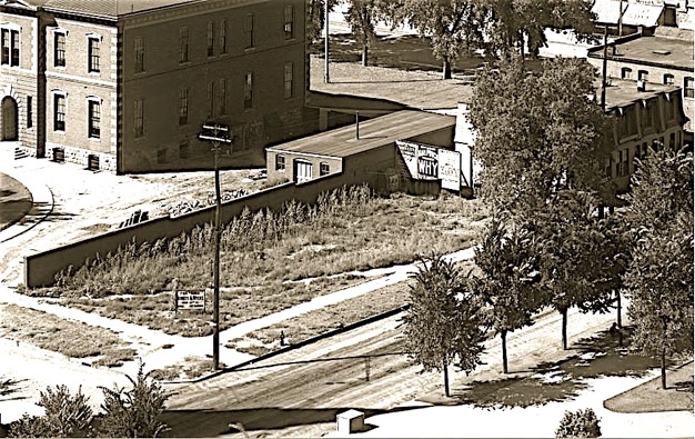
Here’s the same photo showing more detail; Indian ‘Moto Cycle’ dealer and ‘Repair Station’ on SE corner, Broadway Market and Plumbing store across street in the Donald (‘Donaldson’ on the 1905 map) building, which had ‘rooms’ on the second and third floors. There were rooms above the Moto Cycle shop, and a rooming house just to the east. The Broadway School is seen to the left (south).
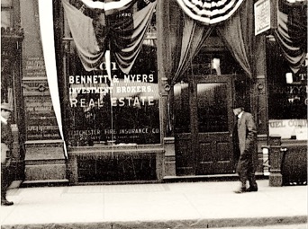
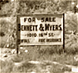
The Paramount apartment building site at this time was a weedy old vacant lot offered for sale by Bennett & Myers.
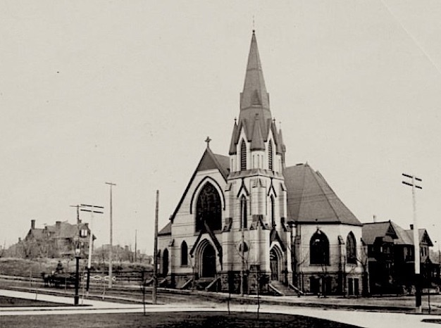
The First United Presbyterian church, located on the southeast corner of 14th and Lincoln, was built in 1883, was called the Capitol Avenue Presbyterian church when it first opened, because that’s what 14th was called in 1883. It was in use for more than 80 years.
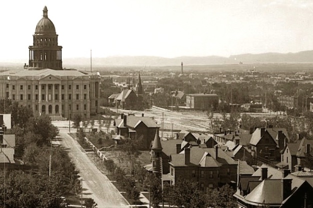
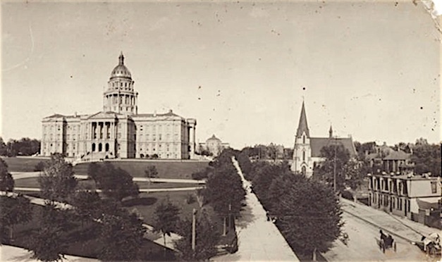
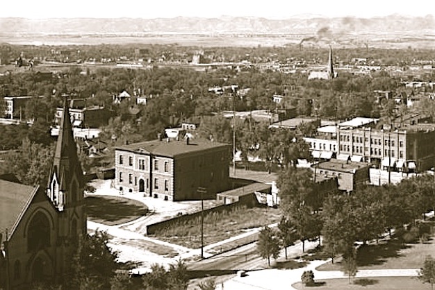
In 1895 the Colorado State Capitol opened, but would not be completed until 1908. It was built on land purchased by Denver and donated by H.C.Brown (sort of - more to this story). This view looking south from 16th and Sherman shows the new Capitol and 14th street on the south side of the Capitol grounds.
The Paramount Apartment Building Story
14th Avenue between Broadway and Lincoln Street - Denver
This early W.H. Jackson photo taken about 1890 shows the Capitol building under construction to the right, and the intersection of 14th and Broadway in the center, looking southwest from 17th and Grant. The ‘Eastside’ of Denver, formerly know as Brown’s Bluff, already had some ginourmous private homes by the time the cornerstone for the Capitol was laid on July 4, 1890. You can see the C.B. Kountze mansion (1882, torn down 1963) at 16th and Sherman. Mr. Kountze was a prominent banker, founder of Colorado National Bank, and maybe wealthiest man in Colorado at the time. The George Schleier Mansion (1880) at 17th and Grant is still there, used as an office building and listed on the National Register of Historic Places, as are several Denver landmarks.
This photo, taken in 1882 from a light pole at 18th and Grant looking south shows the Capitol building site. The Broadway School is there, but the Presbyterian church would not be built until the next year. The red line is on Capitol Avenue east of Broadway (later 14th Avenue). This was the out-in-the-country Eastside, and streets weren't lined up with Denver until years later.


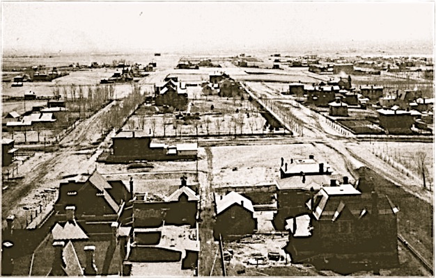
Around 1910 looking south from the Capitol dome showing 14th Avenue between Broadway and Lincoln street.
photo: Denver Public Library
photo: Denver Public Library
Photo: Denver Public Library
-
There has been abundant slow-news-day coverage of this story by the various local news organizations, but most of these reports lack accurate information as to what was on this site prior to these monstrous temples of heritage. So, what was there before the 1970s? The answer depends on the historian, and therefore, the truth can be quite twisted. The story, the truth, the justice continues...
photo - detail of above
1010 16th St.; June 1913; Denver Public Library
photos: Denver Public Library
photo: Denver Public Library
detail of the map above
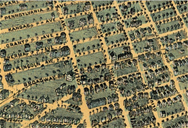
This is a detail of the 1882 map above showing the vacant State Capitol site between Colfax, Capitol Avenue, Broadway and Grant streets. Olive and Pine streets are to the south. Kansas Avenue is between Grant and Pennsylvania.
This is an early ‘Birdseye View’ advertisement map of Denver in 1882, with an eastward view. Although it shows some detail, it is not necessarily accurate.

This is a detail of an 1889 advertisement map drawn by H. Welige showing the neighborhood at that time. The Broadway School is shown, and what appears to be tenement buildings on the corner. The unfinished Capitol was conceptualized because it’s shown sideways here with the west side facing south.
photo: Denver Public Library
< South -- SLIDE -- North >
Before 1800 - 1880-1908 - 1908-1928 - 1929-1977

Before 1800 - 1880-1908 - 1908-1928 - 1929-1977
-
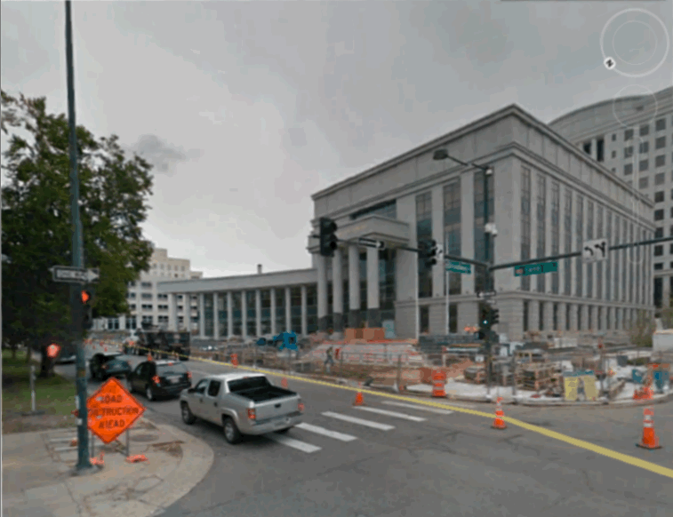
The new Judicial Center opened on Monday, January 13, 2013, and now dominates the downtown Denver location of 14th and Broadway, replacing the so-called ‘file cabinet’ Judicial Heritage building (next to the ‘typewriter’ Colorado History Museum building) built in 1977.

History without fact is fiction, and although this is not an original thought of mine, I do believe it. Fiction, and fiction based on fact, is fine for entertainment if fiction is expected, but alternative explanations presented as historical reporting is not. Many times a theory is applied because of the lack of conclusive information, but this should never presented as fact. This journal continues in an effort to present historically accurate records of the way in which this little part of Denver changed over the years, and to uncover some of the many memories surrounding it - for our mutual entertainment.


This 1905 map shows the area from two sections of Baist’s Real Estate Atlas; Surveys of Denver (plate 13 and 14).